
Digital Vector Maps
Maps play a crucial role in planning localized leaflet deliveries for electioneering, offering several key advantages:
-
Targeted Delivery: Maps allow campaigns to visually identify and target specific geographic areas, including constituencies, neighborhoods, or streets. This ensures that leaflet deliveries are focused on areas with the highest potential impact, maximizing the effectiveness of campaign messaging.
-
Resource Optimization: By visualizing the geographic layout of an area, campaigns can more efficiently allocate resources. This includes planning the most effective routes for volunteers or paid distributors, leading to time and cost savings.
-
Demographic Insights: Maps integrated with demographic data can provide invaluable insights into the population characteristics of different areas. Understanding demographics, such as age, income, or voting history, allows for tailoring messages to resonate with the specific interests and concerns of different voter groups.
-
Increased Engagement: Tailored leaflet deliveries based on detailed maps can lead to increased engagement from the target audience. Personalized content that addresses local issues or concerns is more likely to be read and acted upon.
-
Strategic Decision-Making: Maps offer a visual representation of electoral boundaries and voter distribution, aiding in strategic decision-making. Campaigns can identify key battleground areas where increased efforts could sway the overall election outcome.
-
Tracking and Analysis: Post-delivery, maps can be used to track and analyze the coverage of leaflet campaigns. This feedback loop is essential for evaluating the effectiveness of the strategy and making necessary adjustments for future rounds of distribution.
In essence, the use of maps for planning localized leaflet deliveries enables campaigns to conduct more targeted, efficient, and effective electioneering efforts. By leveraging geographic and demographic insights, campaigns can enhance their outreach and engagement strategies, ultimately contributing to a more successful electoral outcome.
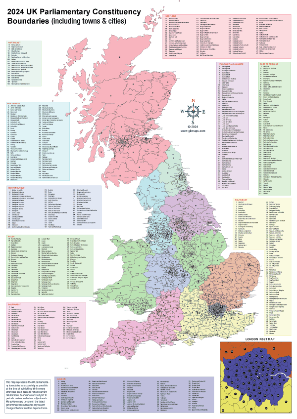
Printed & Posted Maps
Need tangible maps for your campaign office or mail-outs? We provide printed maps with updated electoral and postcode boundaries. Optimize your door-to-door campaign strategy by visualizing precise areas, ensuring efficient resource allocation and maximized outreach.
Printed poster maps displayed in a local campaign headquarters offer significant benefits, playing a crucial role in planning and strategy development for political campaigns. Here's why they are so valuable:
-
Visual Strategy Tool: Printed maps provide a clear, at-a-glance understanding of the electoral landscape. They can highlight key areas of interest, such as voter density, demographic distributions, and historical voting patterns, serving as a constant visual reminder of the campaign's strategic focus.
-
Collaborative Planning: Large, printed maps enable team members to gather around, discuss, and plan campaign activities collaboratively. They facilitate a shared understanding of goals and strategies, encouraging input and engagement from the entire team.
-
Tangible Reference: Unlike digital maps, printed maps provide a tangible reference that can be accessed at any moment without the need for technology. This can be particularly useful in environments where internet access is unreliable or for team members who prefer physical planning tools.
-
Customization and Annotation: Printed maps can be customized with markers, stickers, or notes to indicate areas where efforts have been concentrated, where future activities are planned, or to highlight regions of strategic importance. This layer of customization adds a dynamic component to campaign planning.
-
Local Focus: For local campaigns, printed maps can focus on specific constituencies, providing detailed views of streets, neighborhoods, and communities. This level of detail is invaluable for door-to-door canvassing, targeted leaflet distribution, and organizing local events.
-
Motivational Impact: Visually seeing the campaign's progress and areas of influence on a large printed map can have a motivational impact on the team. It serves as a concrete representation of the work done and the ground yet to cover, fostering a sense of accomplishment and urgency.
-
Accessibility: Printed maps ensure that vital geographic information is accessible to all campaign staff and volunteers at any time, facilitating quick decision-making and strategy adjustments without the need for digital tools.
In summary, the benefits of printed poster maps in a campaign headquarters extend beyond mere aesthetics; they are a practical and effective tool for strategic planning, collaboration, and motivation, ensuring that campaign efforts are precisely targeted and effectively executed.
Bespoke interactive mapping tools
Interactive mapping tools revolutionize electioneering by enabling campaigns to pinpoint and engage specific voter groups more effectively. These tools facilitate the visualization of demographic data, voting patterns, and other critical insights on a dynamic map, allowing for the strategic targeting of areas for leaflet drops and door-to-door visits. By integrating real-time data, campaigns can adjust their strategies to focus on high-priority areas, optimizing resource allocation and enhancing the impact of direct voter engagement efforts. Interactive maps also support on-the-ground teams by providing them with detailed, navigable information about their assigned areas, ensuring that no effort is wasted and that every interaction counts towards winning votes. This targeted approach, powered by advanced mapping technologies, offers a significant advantage in crafting personalized, impactful campaign strategies.